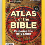
 The Atlas of the Bible by Jean-Pierre Isbouts (Washington, DC: National Geographic, 2018), contains 17 maps:
- Map 1, “Lads of the Bible Today” (pp. 6-7).
- Map 2, “The Journey of Abraham” (pp. 24-25).
- Map 3, “The Travels of Jacob” (31).
- Map 4, “The Goshen Region” (p. 37).
- Map 5, “Exodus in the Sinai” (pp. 42-43).
- Map 6, “Joshua and the Conquest of Canaan” (p. 49).
- Map 7, “Territories of the 12 Tribes” (p. 55).
- Map 8, “Jerusalem during the Time of the Monarchy” (p. 60).
- Map 9, “The Kingdom of Saul, David, and Solomon according to the Bible” (pp. 62-63).
- Map 10, “The Kingdoms of Israel and Judah” (p. 69).
- Map 11, “Kingdom of Judah in the Days of Josiah” (p. 72).
- Map 12, “Division of the Kingdom of Herod the Great” (p. 83).
- Map 13, “The Ministry of Jesus in Lower Galilee” (pp. 92-93).
- Map 14, “The Road to Jerusalem” (p. 96).
- Map 15, “Key Sites of the Passion” (p. 99).
- Map 16, “Paul’s Missionary Journeys” (pp. 108-109).
- Map 17, “Roman Palestine” (p. 111).
